
TRAILS
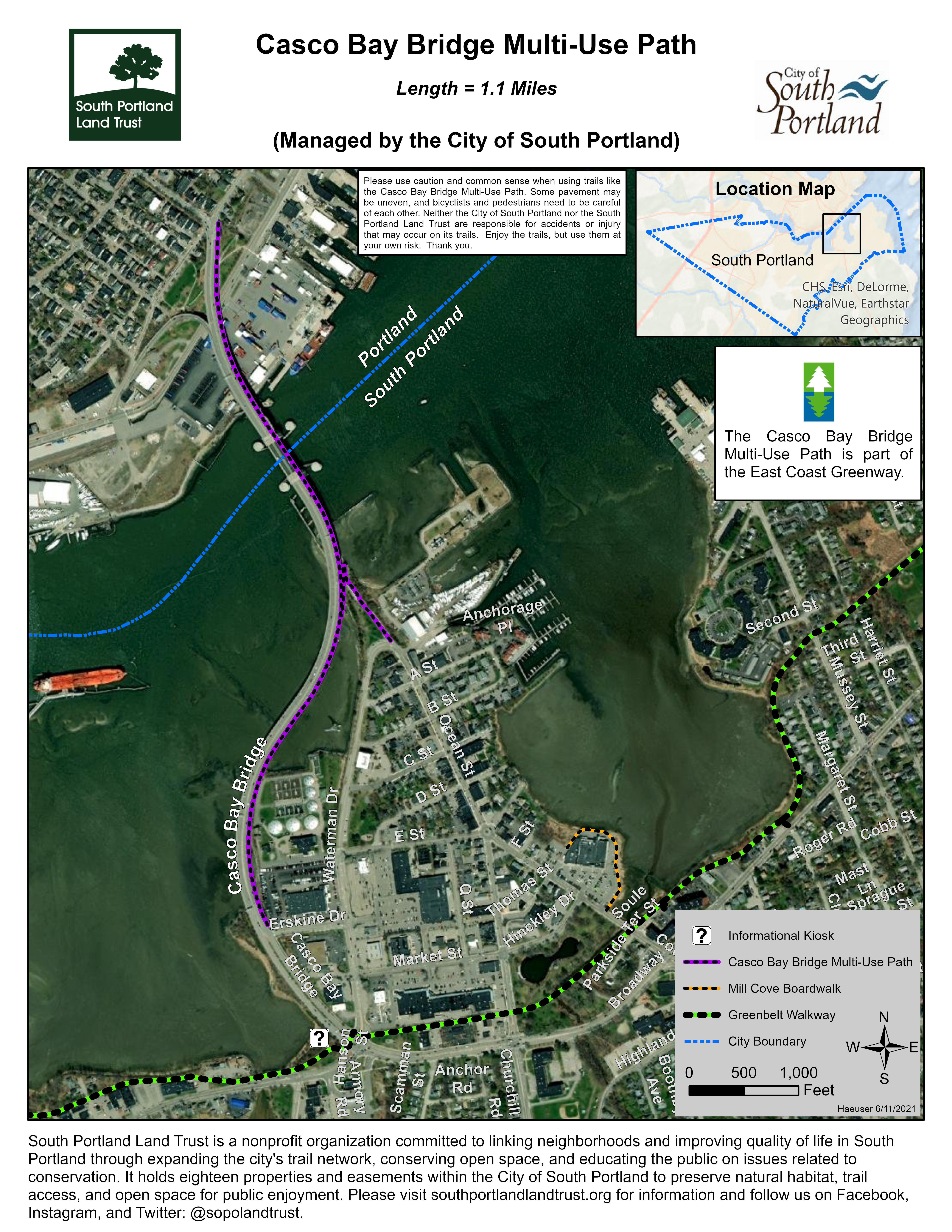
Casco Bay Bridge Multi-Use Path
This 1.1-mile multi-use path is part of the East Coast Greenway and connects South Portland and Portland.
Managed by the City of South Portland
Trail Heads
the casco bay bridge multi-use path HAS two PRIMARY ACCESS POINts:
South Portland: One way to get onto the multi-use path is from the western end of Erskine Drive. Another is from Thomas Knight Park at the loop intersection between Ocean Street and Waterman Drive via the pedestrian bridge/ramp that connects the park with the Casco Bay Bridge. There are several parking spaces on the Ocean St/Waterman Dr loop.
Portland: The multi-use path is on the southeast side of the Casco Bay Bridge. It starts at the intersection of State Street and York Street.
About the Trail
This is a 1.1-mile paved walk- and bike-way that extends along most of the Casco Bay Bridge between Portland and South Portland. While there are bike lanes on both sides of the Casco Bay Bridge, the multi-use path is only on the southeast side and is separated from traffic by a permanent concrete jersey barrier. Biking as well as walking is allowed on the path, but bicyclists need to use caution around pedestrians because the path is not much wider than a regular sidewalk. The bridge gradually rises from both ends toward the draw bridge in the middle. Some of the sections of the ramp connecting the bridge and multi-use path with Thomas Knight Park are a little steeper, although the ramp does meet ADA standards.
Please use caution and common sense when using trails like the Casco Bay Bridge Multi-Use Path. Some pavement may be uneven, and bicyclists and pedestrians need to be careful of each other. Neither the City of South Portland nor the South Portland Land Trust are responsible for accidents or injury that may occur on its trails. Enjoy the trails, but use them at your own risk. Thank you.
Photo Gallery
Coming soon!